Do you want to know what a street looked like years ago? With Google Maps you can do it

Time travel is a subject that has always been an object of fascination, both in literature and in cinema. It is a desire that has captivated the mind of man for centuries.
Although unfortunately this is something that even science has not been able to fulfill, Google offers you a way to take you on a journey through time, and all from the comfort of your home.
In that sense, the cars of Google Maps From its beginnings to the present, they have traveled with some frequency through the places and streets of the most popular cities. Taking this into account, Google Maps allows the user to access a view of those streets captured in the past tense. It is worth mentioning that this is not a literal time jump, but the opportunity to navigate to specific years.
It is necessary to highlight the work carried out by the Street View cars who are in charge of scan the street environment where they transit generating photos of this in 3D for later put together a realistic view of the place that can be presented to the user.
After a while, and depending on how important the street is, Google makes your car go through it again renew sightthus storing the previous scans, so that the user can access them and check if the place has changed over time or remains the same.
It is worth mentioning that all You can do this only from the web versionsince the Street View application for smartphones does not have the time picker available in all countries, nor does the Google Maps application.
In the case of iOS mobile devices, only the year in which the photographic capture was made is shown, but it does not allow you to see the previous ones. To do this from the web version of Google Maps do the following:
Go to Google Maps. Next, search for the street you are interested in seeing and then tap on the street view thumbnail.
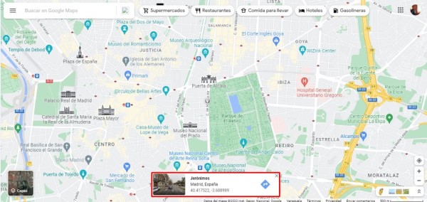
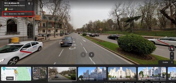
Once this is done click on the words street view arranged in the box displayed at the top left of the screen.
There will appear a picker with dots that indicate the years in which the Google Maps vehicle passed through the selected street.
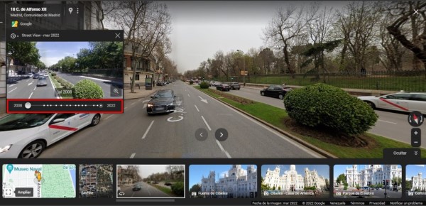
You will have the opportunity to move forward or backward by moving the starting point. By stopping at a year and clicking on the box image the street view in that year will be displayed
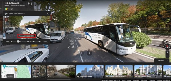
After placing yourself in the image of a specific year you will have the option Share or insert the image by clicking on the three points located in the box at the top left.
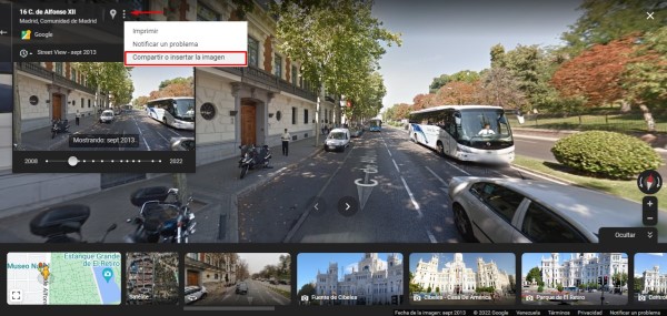
You can copy the generated link and send it to the phone so that when you open it, the street in the year you have selected is displayed and you can explore it with the view it had at that time.
